• Skip to content
  • Skip to navigation
Close

Boulia

Shire Council

    • Home
    • Council
        BackCouncil
      • Mayor's Message
      • Our Vision, Our Purpose, Our Values
      • Councillor Profiles
      • The Executive Team
      • Council Meetings
      • Corporate Structure
      • Council Documents
      • Fees and Charges
      • Employment Opportunities
      • Quotations & Tenders
      • Channel Country Chatter
      • Complaints
      • Planning and Development
      • Right To Information
      • Boulia Shire Council Official Ambassador
      • RAPAD
      • Your Government
      • The Outback Way – Australia’s Longest Shortcut
      • Regional Development Australia (RDA)
      • Disaster Management
    • Services
        BackServices
      • Hire of Facilities
      • Online Forms
      • Library
      • Boulia Sports & Aquatic Centre
      • Refuse & Rubbish Complex
      • Central West Biosecurity Plan for Weed and Pest Management
      • Biosecurity Industries / Agriculture / Livestock
      • Aerodrome
      • Housing
    • Community
        BackCommunity
      • Community & Business Directory
      • School
      • Australia Day Awards
      • Fire Station
      • Health
      • Police & QGAP
      • Shire Hall
      • Recreation & Parks
      • Grant Funding
      • Drought & Wellbeing Support
      • Boulia Community Support Services
      • COVID-19
    • Tourism
        BackTourism
      • Min Min Encounter Visitor Information Centre
      • Boulia Heritage Complex
      • Min Min Hotel Site
      • Natural Attractions
      • Maps, Directions & Self-Drive Loops
      • Police Barracks
      • Safety Tips
      • Urandangi
    • History
        BackHistory
      • History of Boulia and Urandangi
      • Shire Timeline
      • Traditional Owner Groups
    • Events
    • Contact
     
    1. Home
    2. Tourism
    3. Maps, Directions & Self Drive Loops
    Back

    Maps, Directions & Self Drive Loops


    Good to Go Tourism promo


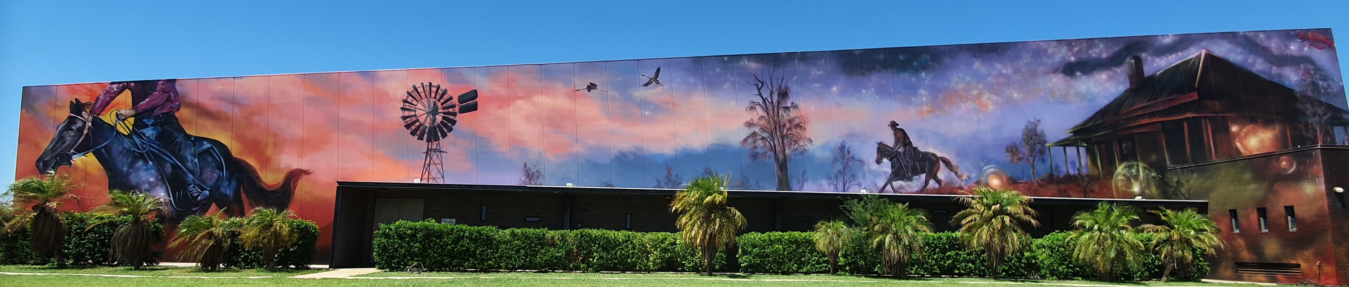
    Boulia Shire is situated in Western Queensland and encompasses an area of 61,635 square kilometres. There are two towns in the shire with the town of Boulia, sited on the banks of the Burke River, being the main administration area for the local Boulia Shire Council. It is home to the mysterious Min Min Light, an unexplained ball of light that can follow cars and people for miles and then wink out of existence.

    Urandangi is the other town in the north of the shire. The majestic Georgina River runs near this tiny township and its tranquillity gives us an insight into its past – you can see why it has inspired songs and poems to be written about it.
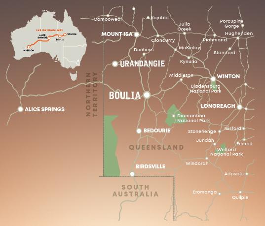
     

    Map of region surrounding Boulia


    Boulia to:

    Mt Isa  - 303km

    Bedourie  - 194km

    Birdsville  - 383km

    Winton  - 366km

    Longreach  - 536km

    Alice Springs  - 814km


    Urandangi to:

    Mt Isa  - 183km

    Boulia  - 307km 

    Camooweal  - 250km 

    Tobermorey  - 98km 


    Maps:

    • Map of Queensland
    • Central West Map
    • Boulia Shire Map
    • Map of Boulia Town Centre
    • Lake Eyre Basin ‘Aboriginal Way’ Map
    • Link to RACQ
    • Link to Bureau of Meteorology
    • The Outback Way


    Self-drive Loops:

    • Channel Country Drive
    • Diamantina Bedourie Loop
    • Drovers & Pioneers Trail
    • Outback Camel Festival Trail
    • Outback Highway Story
    • Drive North West Queensland

    Page Navigation

    SELECT
    • Min Min Encounter Visitor Information Centre
    • Boulia Heritage Complex
    • Min Min Hotel Site
    • Natural Attractions
    • Maps, Directions & Self-Drive Loops
    • Police Barracks
    • Safety Tips
    • Urandangi

    Footer Content

    © 2019 Boulia Shire Council

    All content © Boulia Shire Council. All Rights Reserved.

    Powered by Jadu Continuum.

    • Privacy
    • Site Map
    • Contact
    • Right to Information
    • Login
    Back to the top